

What two French hilltop castles reveal about composition, launch points, and knowing when to stop climbing.
The most useful question in aerial landscape photography is often simple: what does this viewpoint explain?
A higher position can reveal the shape of a ridge. It can also make a building smaller, flatten the hillside that gives it scale, or remove the foreground that connects it to its surroundings. Altitude is a compositional choice, not a measure of photographic success.
Philippe Contal’s September 20, 2026, photographs of Montferrand and Viviourès, made with a DJI Avata 2 in southern France, offer a useful case study. Two ruined castles occupy opposing heights near Montpellier. Their shared landscape gives the photographs a story: buildings, rock, and the valley between them.
For a photographer planning a road trip or an aerial landscape series, the lesson travels well. Before deciding how high to fly, decide what relationship the image needs to show.
Give the landscape a job
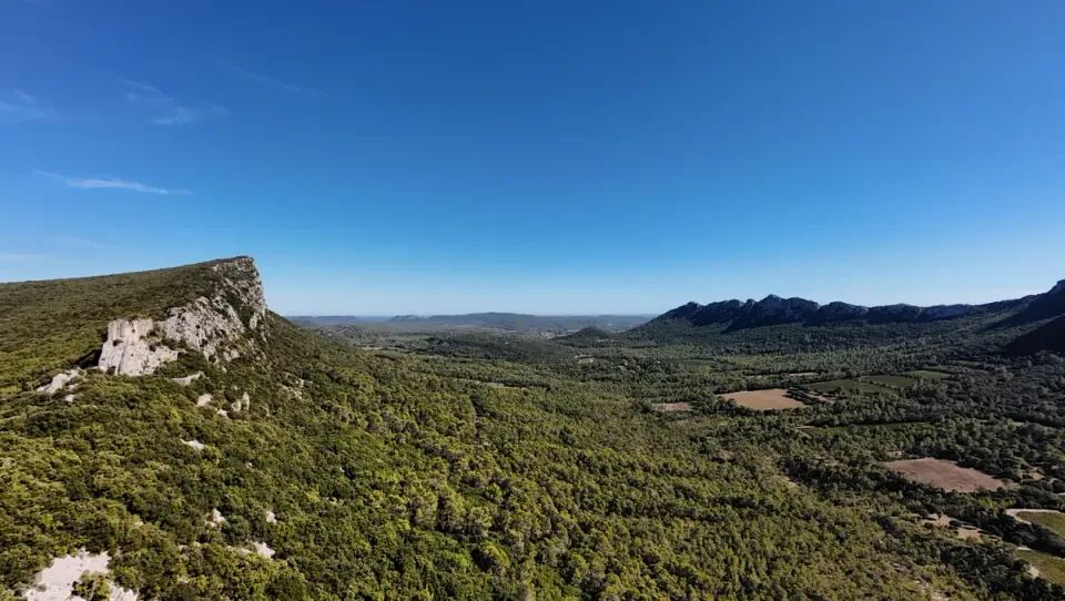
In the opening photograph, Viviourès appears on the left, close to the cliff. Montferrand is much smaller, on the opposite ridge in the right half of the frame. Woodland and open parcels fill the space between them.
That difference in scale is useful. One castle introduces the scene; the other draws the eye into the distance. The valley connects them and makes their separation visible.
A tighter image of either ruin would tell a different story. It might describe a wall more clearly, but it would lose the relationship between the two sites.
Before a flight, finish this sentence: “I want the viewer to understand…” If the answer is “how this building sits above the valley,” the slope belongs in the frame. If it is “how the walls follow the rock,” a view that separates those edges may matter more than a sweeping panorama.
Build a sequence around three questions
Instead of collecting several versions of the same dramatic view, give each photograph a purpose.
Where is the subject? Make an establishing image that includes enough surrounding terrain to explain its position. The subject does not have to fill the frame.
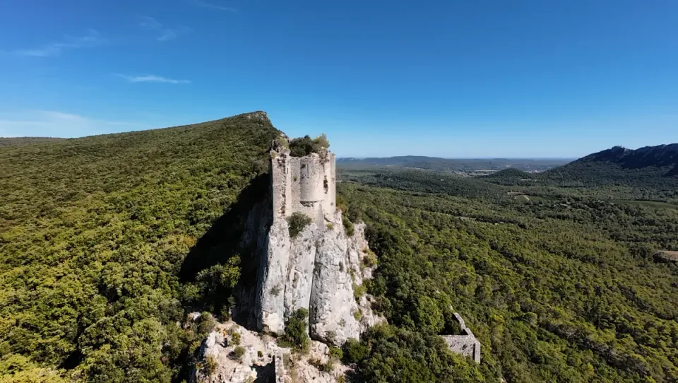
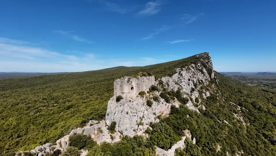
What supports it? Look for the connection between the structure and its foundation. At Viviourès, the original report describes pale masonry rising from a limestone outcrop. Similar colors can merge visually; changes in texture, openings, and the outline of a wall help distinguish the built surface from the natural one.
What continues beyond it? Include the ridge or hillside extending away from the building. This makes the ruin part of a landscape rather than an isolated object.
These are three visual questions, not three mandatory flight maneuvers. Answer only those that can be photographed within the permitted and safely observable flight area. A useful sequence can also combine aerial images with photographs made from an authorized ground position.
Your launch point changes the available picture
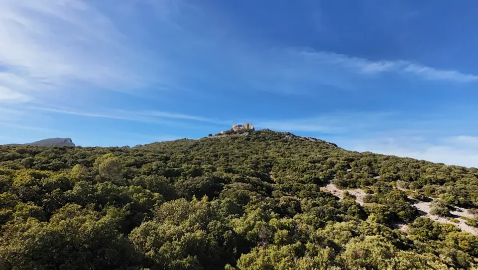
At Montferrand, Contal encountered a height ceiling that prevented the elevated viewpoint he had wanted. The terrain rose toward the castle, so climbing above the launch point did not produce the same amount of height above the ruins.
The report does not establish the exact ceiling or its cause. The referenced 120 meters is approximately 394 feet, not an established measurement from this flight. Without flight logs and a retrospective settings check, it would be misleading to call this a universal Avata 2 limitation or a proven fixed 120-meter cap.
The photographic consequence is clearer: the hillside remained prominent. The ruins appeared above the vegetation rather than beneath a commanding overhead viewpoint.
That became a usable composition. The slope gives the castle its position and scale. Removing it would have changed what the photograph explained.
When planning a similar image, consider the terrain between an authorized launch position and the subject. A setting or height reading alone cannot tell you whether the desired viewpoint is available. If it is not, change the composition, choose another permitted position, or make the photograph from the ground.
A height reading is not a flight authorization
This case study took place in France. Its discussion of European rules should not be converted into a US rule by changing meters to feet. Aircraft settings, terrain clearance, airspace permissions, and access to a launch location are separate questions.
For US readers, the FAA distinguishes purely recreational operations from flights governed by Part 107. Its recreational guidance calls for visual line of sight or a co-located visual observer in direct communication, limits recreational flight to 400 feet in Class G airspace, and requires prior authorization in the specified controlled airspace. Those points are only part of the applicable requirements. Consult the FAA’s current guidance for your operation and location.
For a visit to these French sites, check current French requirements and site access separately. The source report identified access restrictions; it is not a current access notice or a flight itinerary.
Keep the gear decision tied to the image
The Avata 2 was the aircraft used for this series. That fact does not establish that an FPV drone is the best purchase for every landscape photographer, or that another drone would have resolved the specific ceiling encountered here.
Start with the obstacle you can identify. If the photograph lacks a clear subject, buying another aircraft will not supply one. If the ridge disappears from the composition, reconsider the viewpoint. If the desired flight is unavailable, additional batteries will not make it permissible.
Keep your current equipment when it can already make the image you need. Consider different equipment only when a verified limitation matters to your work and the alternative demonstrably addresses it.
Choose a drone for the photographs you want
If you need a drone, these two existing US product records cover different creative priorities. Both selected packages are Fly More Combos; check the controller, batteries, seller, and exact bundle before ordering. A larger kit is only useful if you will use its contents.
| Your priority | Relevant option | What it changes | Main trade-off |
|---|---|---|---|
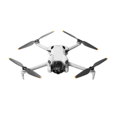
| Deliberate landscape stills and conventional aerial video in a compact travel kit | DJI Mini 4 Pro Fly More Combo with RC 2 | DJI specifies a three-axis mechanical gimbal and JPEG/DNG photo capture, giving you stabilized framing and raw files for editing. | It is a wide-angle camera rather than a choice of optical focal lengths. Standard and Plus battery packages differ; check the exact kit. |
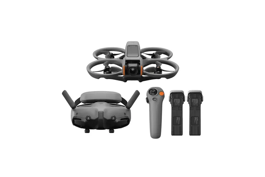
| Immersive moving viewpoints through goggles | DJI Avata 2 Fly More Combo with three batteries | The FPV system puts the moving viewpoint at the center of the experience. It is the aircraft used for the photographs in this field account. | The goggles and controller add equipment to carry, and FPV operation requires appropriate training and visual observation. This outing does not prove an advantage for still photography. |
Choose the Mini 4 Pro if your main goal is to compose landscape photographs and make conventional aerial video while keeping the aircraft compact. See the Mini 4 Pro US product record.
Choose the Avata 2 if immersive FPV footage is an important part of the work you want to create and you are prepared for that operating workflow. See the Avata 2 US product record.
Keep your current drone if it already provides the viewpoint, camera control, and files you need. Neither recommendation establishes permission to fly at these sites or guarantees that the higher composition would have been available. The Mini 4 Pro was not used during this outing; the comparison above is an editorial interpretation of DJI’s Mini 4 Pro specifications and Avata 2 specifications, checked October 3, 2026.
The affiliate cards below link to Amazon US buying options. Pricing, stock, and seller availability have not been checked for this selection.
Let the viewpoint explain something
The two castles do not need matching viewpoints. Viviourès lends itself to photographs showing the continuity between masonry and rock. Montferrand can be understood through the hillside rising toward its silhouette.
The stronger series comes from recognizing that difference. Each image contributes something the others do not.
Before climbing higher, look at the frame you already have. Does it show the relationship you came to photograph? If it does, the terrain may already be doing the most important work.
Continue exploring
For a different use of the same aircraft, read Canyon du Diable: an FPV landscape story. For another example of starting with the intended photograph, see the 33-pound camera bag at Peyrepertuse.
Recommended gear
Find your next piece of gear
Find the setup that fits your plans, then explore prices and buying options on Amazon.
DJI
DJI Mini 4 Pro Fly More Combo
The DJI Mini 4 Pro is a compact folding drone for deliberate travel photos and conventional aerial video. It suits trips where camera control matters but pack space is limited.
DJI
DJI Avata 2 Fly More Combo
The DJI Avata 2 is an FPV system for immersive, moving viewpoints with goggles and a compatible controller. Its role differs from a conventional drone used to compose distant landscape stills.
Transparent evidence
Method and limitations
Independent US adaptation based on Philippe Contal's published September 20, 2026 field account, checked against the public source on October 3, 2026, and visual inspection of four credited photographs. The editorial team developed the composition analysis from that evidence. This is first-hand photographic evidence from the contributor, not a controlled aircraft test. FAA recreational guidance was checked separately.
- No flight logs, exact height ceiling, retrospective settings verification, or controlled aircraft comparison are available.
- This article does not establish current permission to access or fly at either site.
- US flight guidance is a limited contextual summary; the applicable operating category and location must be checked separately.
- The Mini 4 Pro was not used on this outing. Its inclusion is an editorial recommendation based on DJI specifications, not a field comparison. Current seller, stock, and bundle contents must be checked before purchase.
Five key takeaways
- Choose altitude to explain a relationship in the landscape, not simply to maximize height.
- An establishing view, a foundation view, and a ridge view can give a photo series distinct purposes.
- Terrain rising from the launch point changes how much height is gained above the subject.
- The observed ceiling does not establish a fixed 120-meter limit for every DJI Avata 2.
- Improve the viewpoint before replacing equipment, and check flight rules and ground access separately.
Frequently asked questions
Does flying higher always improve a drone landscape photograph?
No. A higher viewpoint can reveal a ridge but can also reduce the subject's scale or remove useful foreground. Choose a permitted viewpoint that explains the relationship you want to show.
Was the DJI Avata 2 limited to 120 meters during this flight?
The source report describes a height ceiling but provides no flight logs or retrospective settings check establishing its exact value or cause. It does not prove a universal 120-meter limit.
Do US drone rules apply to these French castles?
No. The outing took place in France. US readers should consult FAA guidance for US operations and the applicable French requirements for a flight in France. Airspace permission and ground access require separate checks.
Should I buy an FPV drone for landscape photography?
This series does not establish a general buying recommendation. Keep your current aircraft if it can make the intended image, and consider an alternative only when a verified limitation matters to your work.
Primary sources
- faa.gov · Verified 2026-10-03
- chateaudemontferrand.fr · Verified 2026-10-03
- grandpicsaintloup-tourisme.fr · Verified 2026-10-03
- dji.com · Verified 2026-10-03
- dji.com · Verified 2026-10-03